Topographic Land Survey Software
Autodesk’s infrastructure design software simplifies the identification and mapping of terrain features of a project area.
Autodesk’s infrastructure design software simplifies the identification and mapping of terrain features of a project area.
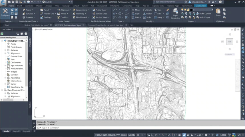
Topographic land surveys measure and map the height, depth, size, and location of man-made or natural features of a site, as well as any changes in elevation. These surveys are used in conjunction with boundary surveys to create accurate an existing conditions model of the project.

Topographic land surveys are an important component for roadways, bridges, housing, buildings, or other construction projects. The surface features and terrain that are mapped in a topographic land survey allow architects, engineers, and builders to understand how the site will impact design and construction. It enables them to make better planning decisions before ever breaking ground.
The Architecture, Engineering and Construction (AEC) Collection simplifies topographic survey mapping to generate more accurate existing site conditions models that can be integrated with intelligent, 3D model-based design workflows to enhance efficiencies and design quality.
Survey projects advance in organized stages. For effective project workflow, data must be collected, managed, and distributed to appropriate teams. The Autodesk AEC Collection helps streamline the topographic survey phase and effectively integrate it into the project workflow.
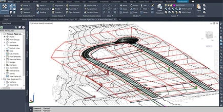
The Autodesk AEC Collection includes tools that facilitate more efficient topographic survey workflows and keep context models up-to-date between the field and office.
Create unified control points on models and site elements, then bring model accuracy to the field for more accurate layout processes. Improved field layout improves the entire construction planning process.

Autodesk’s model-based design approach in topographic survey software delivers accurate data that is quickly processed for automated production drafting. Streamlining your jobsite surveys reduces your overall project timeline.
Digital mapping delivers an integrated framework in which to collect, manage, visualize, and analyze field data. You’ll be able to easily share data with other vendors or decision-makers, for improved workflow.

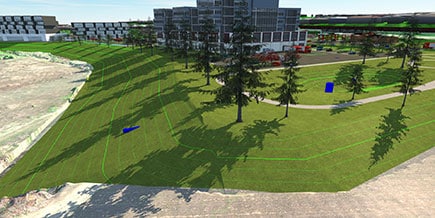
The AEC Collection can meet all your survey needs, from infrastructure projects to industrial, commercial, residential, or recreational construction.

See how Autodesk’s robust and scalable AEC Collection streamlines topographic mapping workflow and brings more efficiency to design projects.
See how to set up and manage an effective topographical survey workflow by migrating data from InfraWorks into Civil 3D.
Learn how to use base survey data to create models, update those models with new topographical survey data, merge models, and create an effective file management structure.
Make surveying complex sites on tight timelines less challenging. See how one engineering firm successfully surveyed and mapped a 50-acre botanical garden using AutoCAD Civil 3D from Autodesk.
Autodesk’s AEC collection is perfect for land surveyors, civil engineers, and construction pros who want to increase the speed and accuracy of land surveying and drive more efficiency into every workflow.
The AEC Collection delivers the software that helps process field data in parallel with data collection to automatically create production-ready maps. Model creation is seamless and model updates are automatically generated when new data is captured. These advances save time from project start to finish.
Efficiency underpins the AEC Collection database, delivering more utility for topographic surveying. The survey database holds all the control points, known directions, observation measurements, traverse definitions, figures, and standard deviations as collected by the survey. Survey data can be manually or automatically inserted into a drawing when the survey database is updated or when data is imported into the survey database. Data can also be linked between drawings.
The AEC Collection is a single suite of products that will meet all your survey needs, from roadways and infrastructure projects to industrial, residential, or recreational construction. The collection supports ALTA/ACSM surveys, boundary surveys, construction surveys, location surveys, site planning surveys, subdivision surveys, and topographic surveys.