MAPS FOR GIS, CAD, DRONES, & UAV
3D DRAWING SOFTWARE3D MAPPING SOFTWARE
Autodesk’s 3D map-making software and 3D mapping tools put the power to create, analyze, visualize, and share your projects right at your fingertips.
MAPS FOR GIS, CAD, DRONES, & UAV
Autodesk’s 3D map-making software and 3D mapping tools put the power to create, analyze, visualize, and share your projects right at your fingertips.
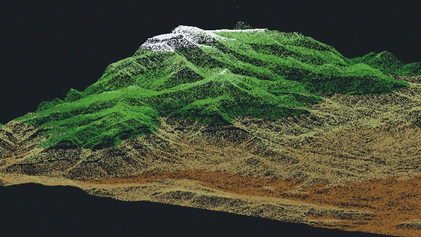
3D mapping technology uses machine vision to aid in profiling objects in three dimensions to map them in the real world, providing the latest technical methods for visualization and information acquisition. 3D mapping requires the profiling of objects in three dimensions to map those objects in the real-world. You can also create 3D effects by detecting the light field using active 3D imaging techniques, and other plenoptic methods.
While there are various types of 3D mapping, Autodesk’s principal focus is on 3D projection mapping, GIS mapping, and Drone mapping.
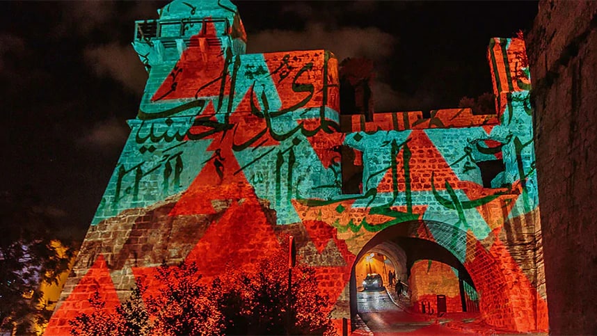
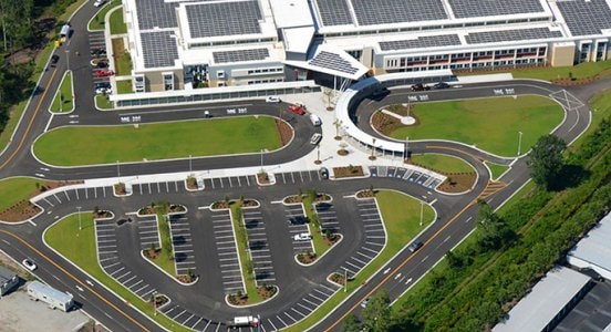
Image courtesy of Andrei Visuals
3D projection mapping allows designers to use physical spaces and objects as the surface for a projection, instead of using a conventional screen. The process is also known as “video mapping,” and results in a visually striking effect. 3D projection mapping uses a combination of four factors (content, projection hardware, surface, and mapping) working in unison to create the visual experience.
GIS mapping is the process of inputting data layers into GIS software to produce a map, providing users with legible information that raw data can’t display on its own. GIS mapping transforms data into visual maps, making it the most effective way to display geographical data.

Drone mapping is the process of acquiring multiple aerial images and then stitching them together digitally with specialized software, creating a larger and more accurate composite image. The practice of drone mapping is called photogrammetry, and is used in fields such as topographic mapping, architecture, engineering, manufacturing, quality control, and more.

A new collaboration between Autodesk and Esri intends to put GIS and BIM at the center of projects, driving smarter decisions, optimized designs, accelerated project approvals, reduced costs, smarter cities, and resilient infrastructure.
Building the bridge between GIS and BIM will change the way we plan, design, and build our future

ANDREI VISUALS
Using 3D modeling features in AutoCAD, Andrei Visuals creates stunning 3D artwork and projection mapping for interactive media events.
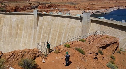
BUREAU OF RECLAMATION
Reality capture and 3D modeling are helping this US government agency manage and protect the Glen Canyon Dam for generations to come.
THOMAS AND HUTTON
Thomas & Hutton, an engineering firm laid the groundwork for energy efficiency with site planning, civil design and landscape architecture services.
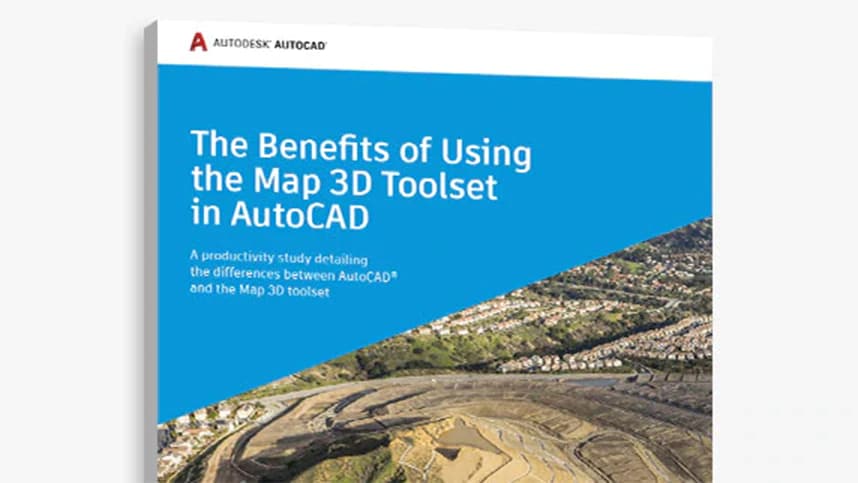
Get access to the specialized Map 3D toolset when you subscribe to AutoCAD. Download the AutoCAD Map 3D productivity study to see how you can save time when performing common mapping design tasks in AutoCAD.
An overview of the changes made to the AutoCAD Map 3D 2021 toolset release.
A series of tutorials that provide an overview of the product and hands-on exercises to help you learn many aspects of AutoCAD Map 3D Toolset.
An infographic that outlines ways of collecting data from physical objects and structures and how it can protect critical infrastructure.
Autodesk’s infrastructure design software simplifies the identification and mapping of terrain features of a project area.
French reality-capture firm surveys some of Europe’s most challenging locales—nuclear sites and other perilous environments.
Getting started in photogrammetry with tools, free resources, and tutorials
Below you’ll find answers to the questions we get asked the most about 3D mapping and Autodesk’s software.
3D mapping allows users to profile objects in three dimensions, providing the latest technical methods for visualization and information acquisition. A 3D map provides a realistic view of a location that can be utilized by local authorities and planners. For the construction sector, a 3D map is as useful as a blueprint. It is very easy to visualize floor plans on a 3D map and identify possible obstructions which may occur during construction.
Yes. Autodesk’s 3D mapping software suite includes AutoCAD, the AEC Collection, Inventor, Revit, and Recap. 3D mapping is often used by advertisers and artists to add dimension, movement, and depth to previously static objects such as buildings or stages.
Autodesk's AutoCAD Map 3D tutorials provide an overview of the product and hands-on exercises to help you learn various aspects of the software and its tools. Some of the tutorials will teach you more about the AutoCAD Map 3D toolset, creating a map file, assigning a coordinate system, connecting to data, and more.
Autodesk offers free 3D Mapping software for students and educators, allowing you to use the same 3D and video mapping software as top professionals around the world. Simply confirm your eligibility, download the software, and get started. Learn more (US Site)
Yes! Drones and drone mapping software are used in construction to more accurately—and safely—capture valuable data from project sites. Drone surveying software allows data from aerial 3D mapping to be utilized effectively and holistically. Learn more (US Site)